Land Use Land Cover Map. 2011
The most valuable natural resource is land, which includes soil, water, and the accompanying plants and wildlife that make up the entire ecosystem. Information on land use helps with planning for development by enabling a better understanding of the land utilization aspects of cropping patterns, fallow areas, forests, grazing lands, waste lands, and surface water bodies. Any terrain's land use pattern reflects the intricate physical processes at play on the earth's surface.

Source: Pre- and post-monsoon observations of groundwater levels from 2011 to 2020 has been collected from Ground Water Department, Jodhpur (Rajasthan). The water table fluctuation maps were generated showing the fluctuation in the pre monsoon period between the years.
Tags
Drainage Density Map Drainage Network Map Geological Map - Formation Geological Map - Lithology Geomorphological Map Groundwater Flow Direction (Pre-Monsoon) Groundwater Flow Direction (Post-Monsoon) GroundWater Fluctuation Map v2 Landform Classification Map v2 LandUseLandCoverMap 2011 LandUseLandCoverMap 2021 LULC Map for Year 2011 and 2021 River and Lake Link Map Satellite Imagery Map 2011 Satellite Imagery Map 2021 Soil Map v2 Unconfined Aquifer Map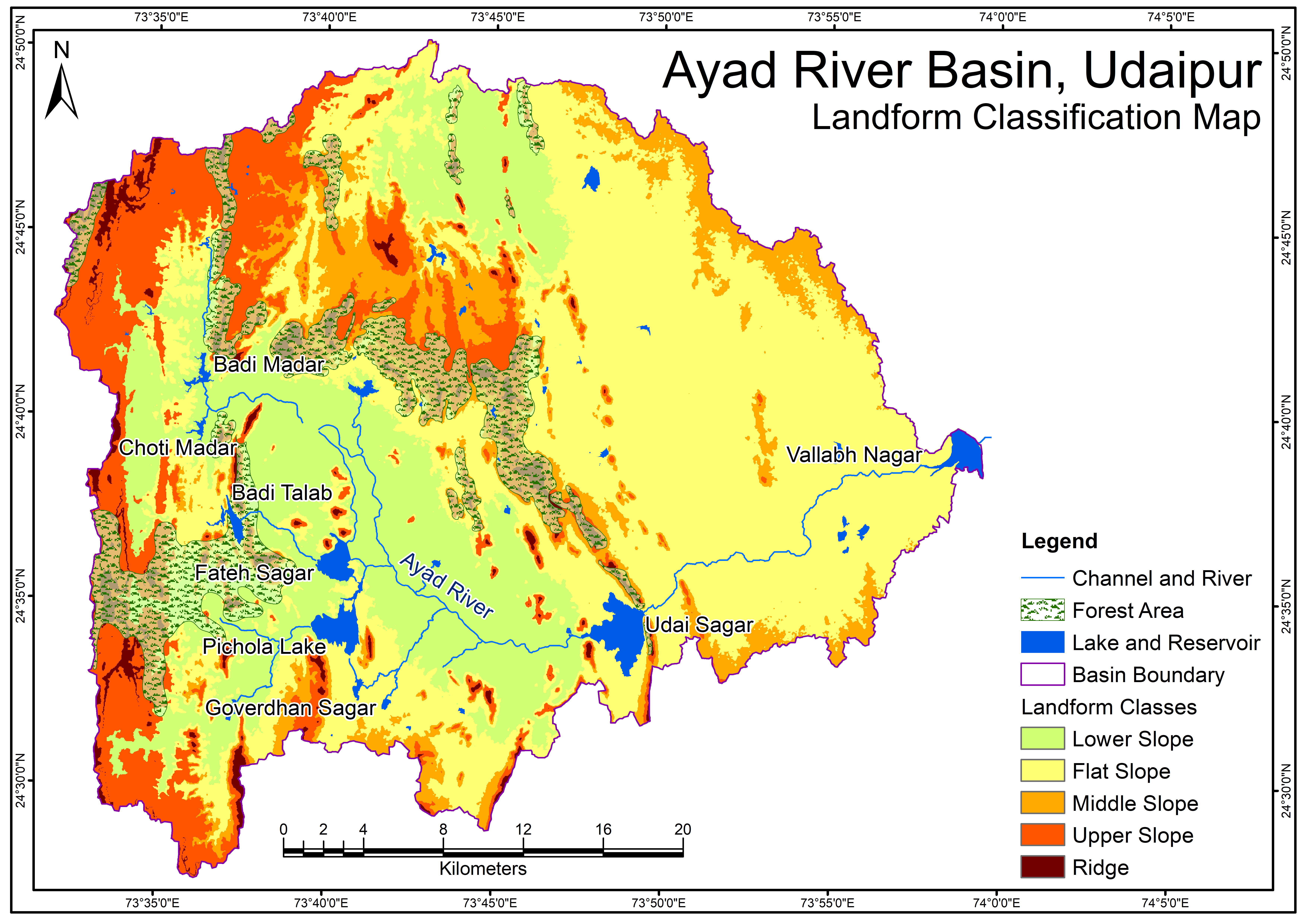
Related images
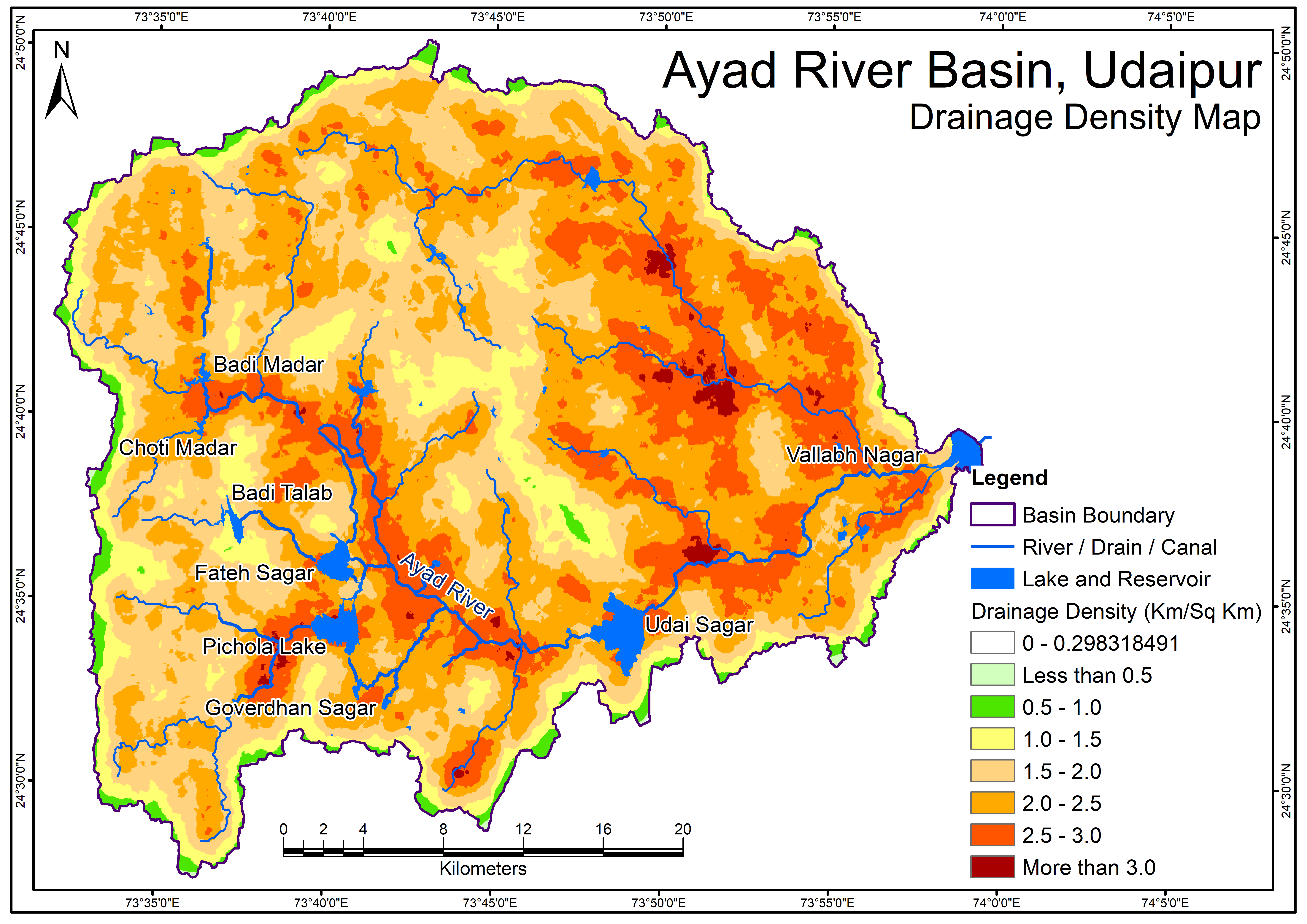
Drainage Density Map
View more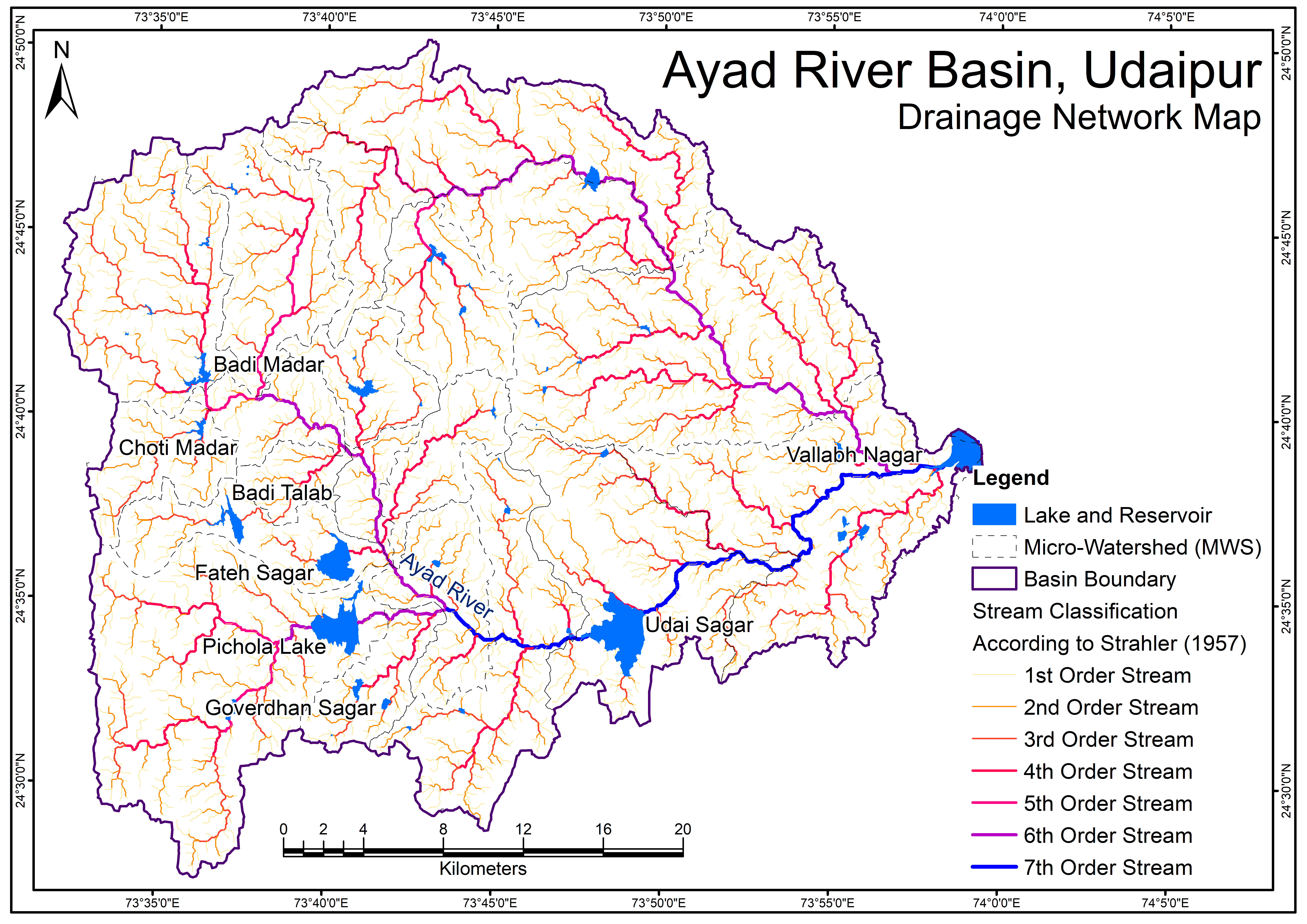
Perfumes
Drainage Network Map
Geological Map - Formation
View more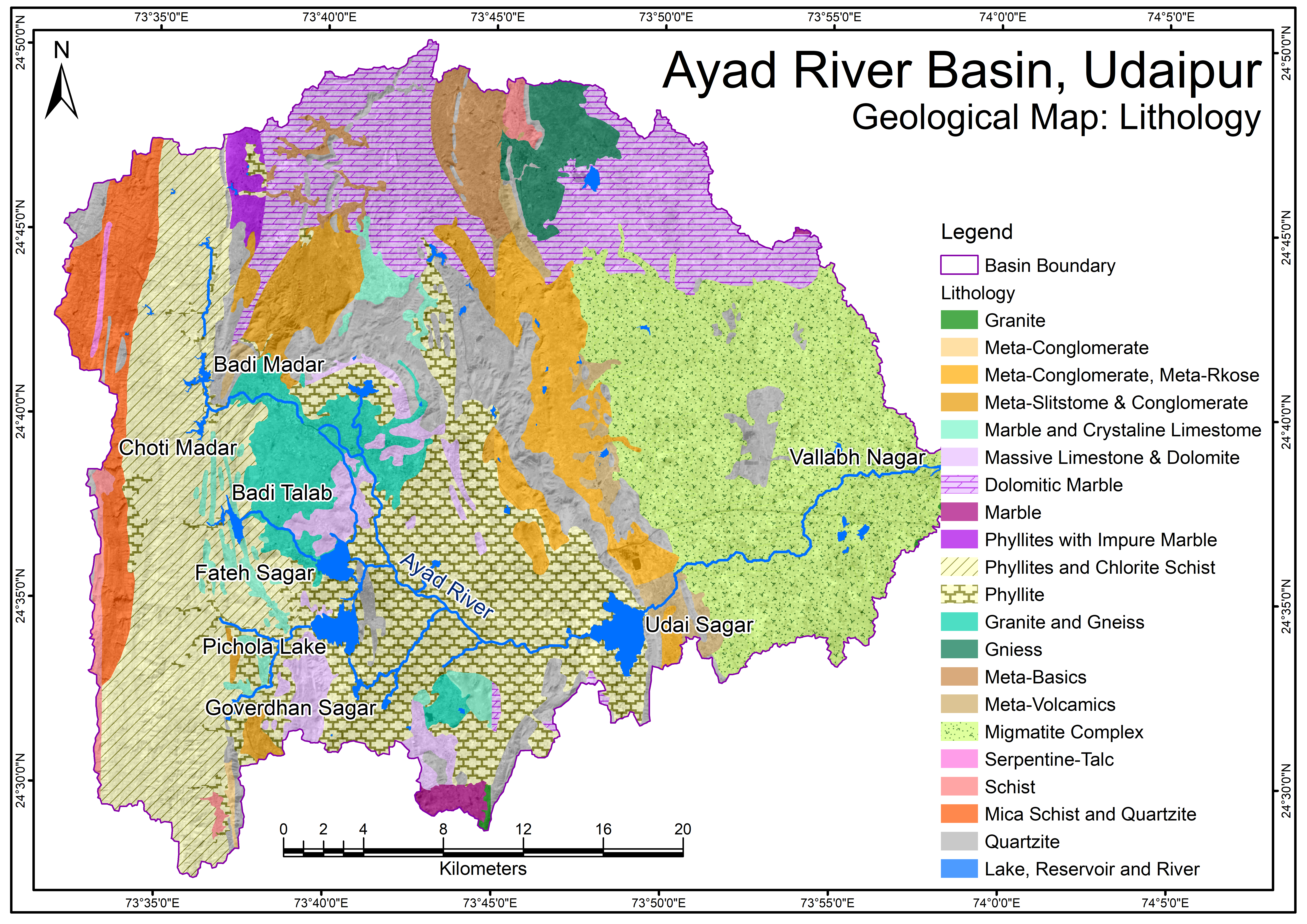
Geological Map - Lithology.png
View more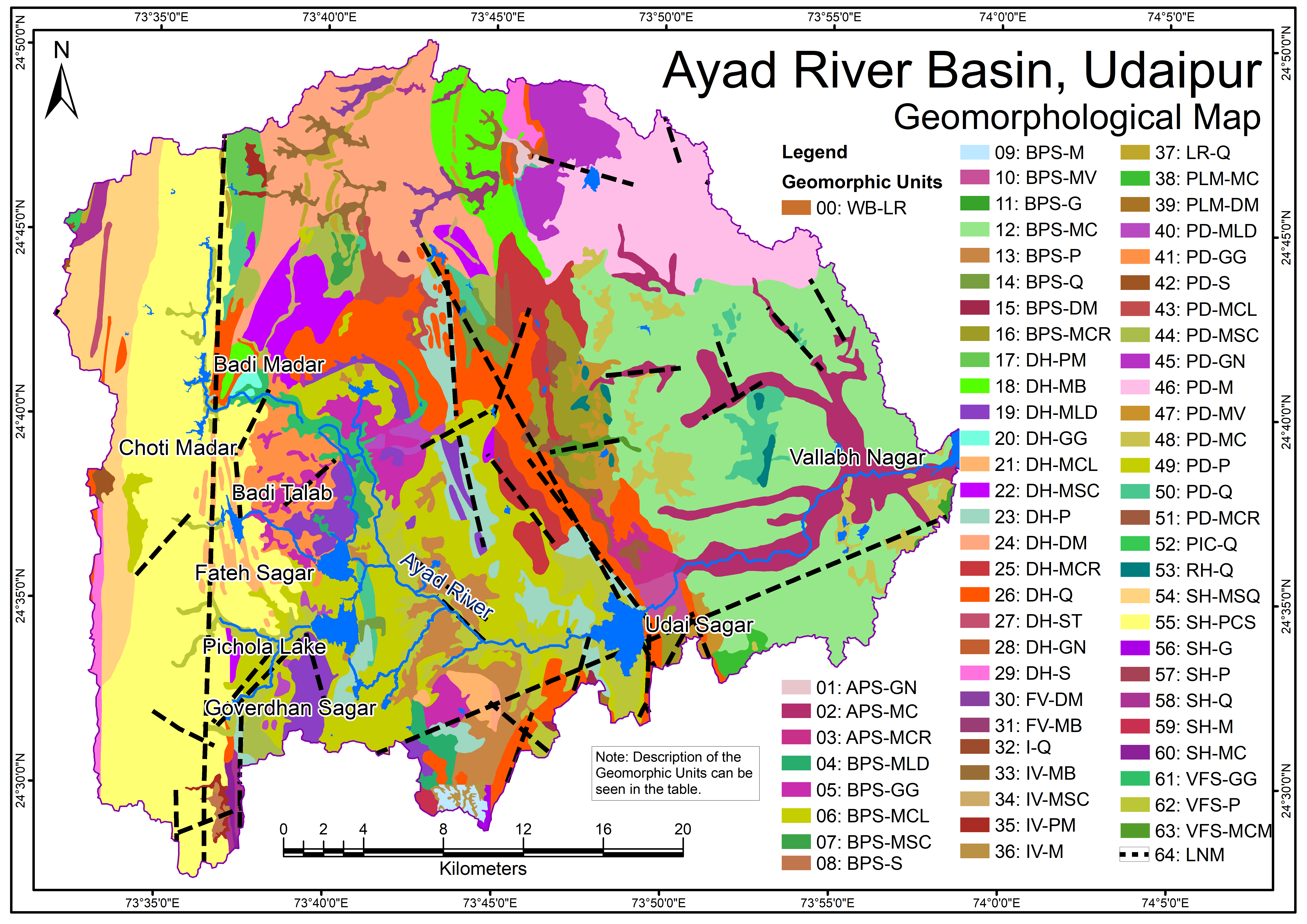
Geomorphological Map
View more.png)
Groundwater Flow Direction (Pre-Monsoon)
View more.png)
Groundwater Flow Direction (Post-Monsoon)
View more